Your Vision.
Your Imagination.
Our Expertise.
3D Modelling
Photogrammetry is a technique that involves capturing and combining photographs to produce 3D Models of objects or landscapes.
Adam Kasprzak Surveying has developed and refined our workflows, to offer clients with more options and possibilities for their 3D-modelling requirements. Our in-house drone, supercomputer and photogrammetric software are used together to produce high-resolution 3D models for various survey applications. Read on for more details.
Past projects (using 95% Photogrammetry)
Topographic Survey (building to building) of 6.0 km of Renfrew Streets (Lochiel and Argyle)
Topographic Survey (building to building) of 1.5 km of Murphy Road, Petawawa
Topographic Survey (fenceline to fenceline) of 12.0 km of Lake Dore Road (Golden Lake)
Equipment
Our fully insured and licensed drone-pilots can collect airborne imagery in Renfrew County and surrounding areas, within 10km of the take-off and landing site.
The equipment’s flight distance permits a wide variety of applications such as remote asset management (hydro infrastructure).
The remotely piloted drone features a 24 megapixel camera and full frame sensor which generates high-resolution data at altitudes of even 100m. Accuracy of this equipment has been tested to 1-2cm in ideal conditions.
With an on site generator, we are unrestricted by project size, and can fly continuously with only brief pauses to hot-swap batteries. Largest survey to date is 300 acres at 70m altitude in one day (2 cm accuracy)
Advantage
The use of drones and photogrammetry for survey applications offers several unique advantages. It allows for highly efficient and cost-effective spatial data collection over large areas, reduces the need for manual measurements, and provides highly accurate and photo-realistic 3D models.
Applications
These models can be used for various purposes, including land surveying, topographic surveying, construction change detection and reporting, environmental monitoring, remote infrastructure inspection, stockpile and quarry volumetric analysis, and even specialized fields such as cultural heritage preservation, among others. Specific examples are:
Topographic surveys of open and mixed locations
Volume calculations for stockpiles, open excavations, quarries, year-to-year change, etc.
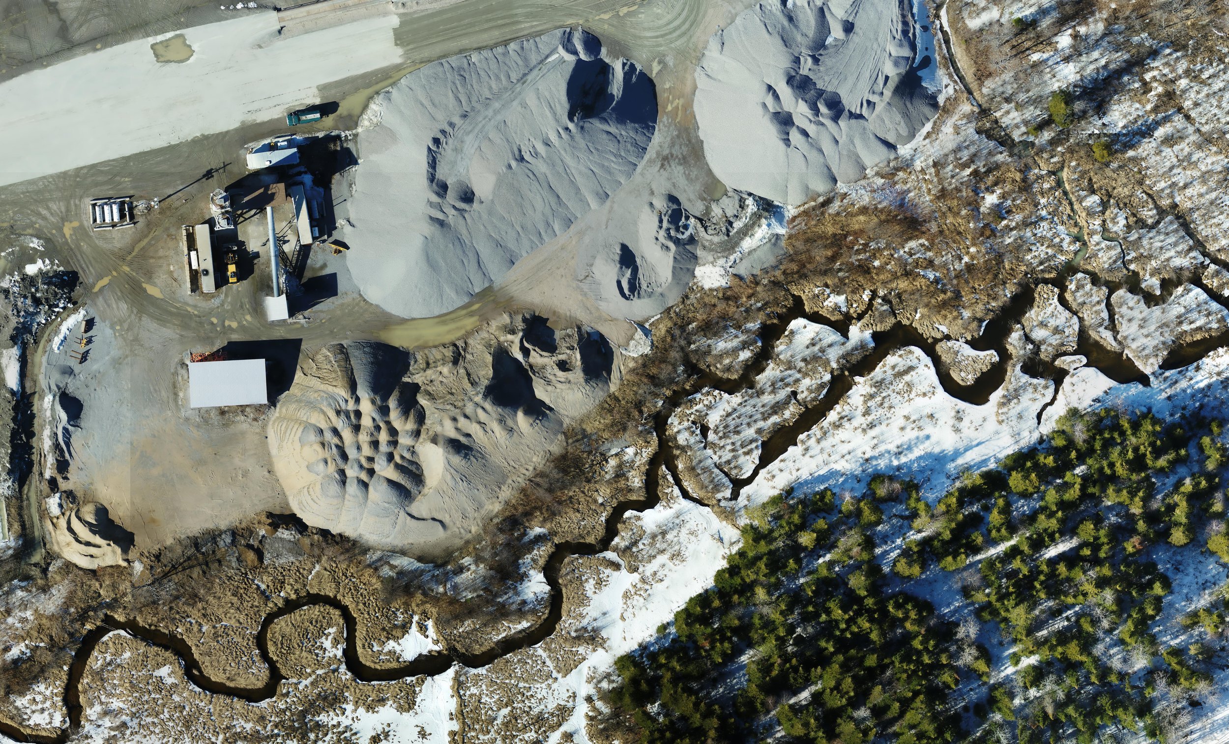
Orthophotos / Orthomosaics / digital terrain models (DTM), and other products
Infrastructure monitoring for (inaccessible) power lines, dams, bridges, and the like
Your Project. We are available to discuss your unique requirements today.
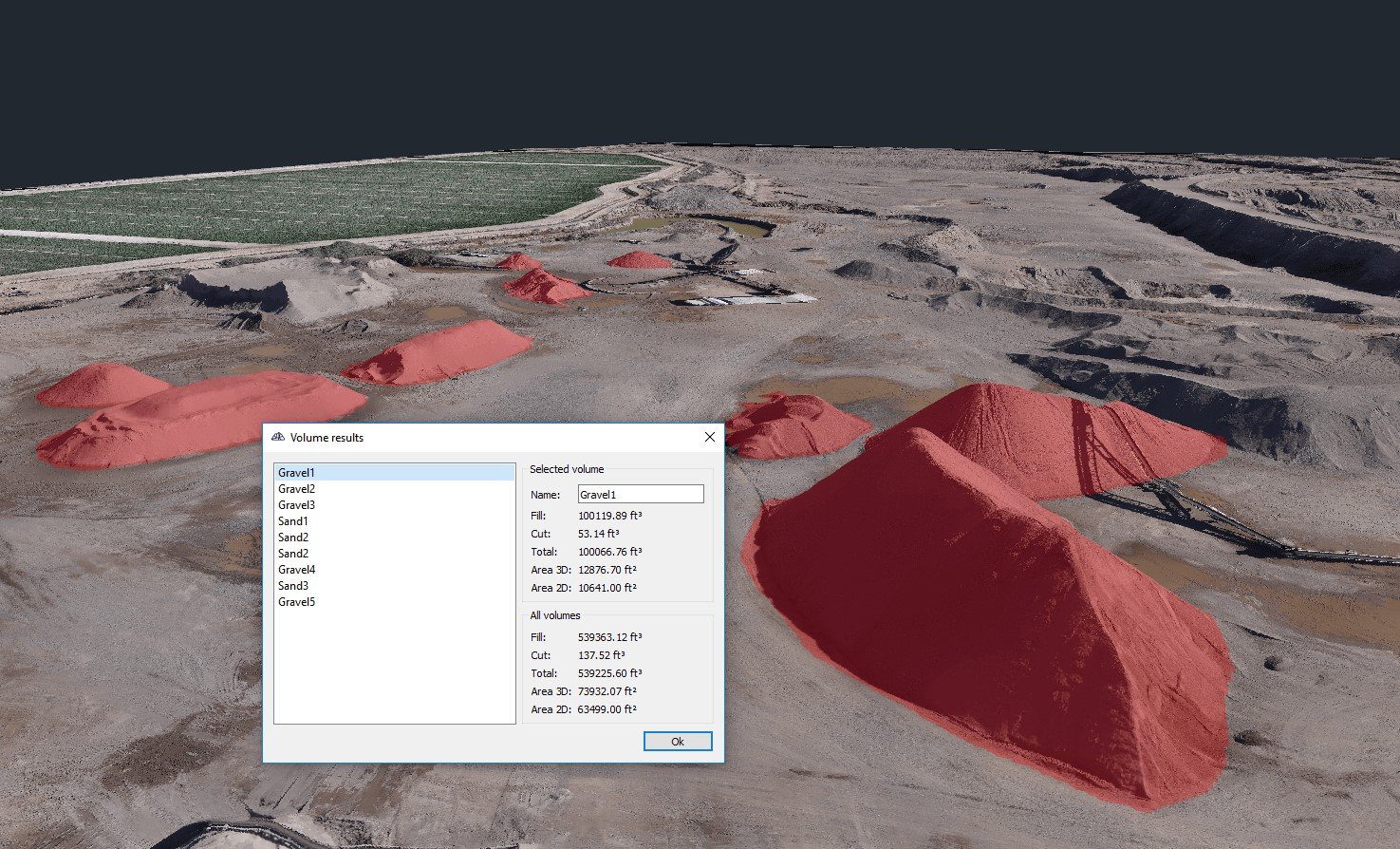
“ Drone-acquired data integrated with 3D modeling software enables accurate volumetric analysis for mining and stockpile management.”
- GEOSPATIAL WORLD
3D Modelling / Drone Survey Process:
-
The first step is to plan the drone flight. This involves determining the survey area and setting up waypoints or flight paths for the drone to follow. The flight plan ensures that the drone captures sufficient imagery to cover the desired area. Multiple altitudes, flight directions, or camera angles may be considered.
95% of Drone Flights are automated, with human piloted flight making up only a small portion of additional corrective imagery to supplement a mission flight.
-
Once the flight plan is set, and ground control points are in-place and surveyed with precise coordinates, the drone is deployed to capture aerial imagery.
Equipped with high-resolution cameras, the drone captures overlapping photos from different angles and altitudes as it follows the predetermined flight path. The overlapping images are crucial for accurate photogrammetric processing.
-
After the drone completes its flight and collects the necessary imagery, the next step is to process the photos using photogrammetry software.
Adam Kasprzak Surveying uses a dedicated supercomputer with network storage to process the large amount of data. The software analyzes the overlapping images and extracts key features and tie points to create a dense point cloud.
-
The extracted tie points are used to generate a dense point cloud, which is a collection of 3D coordinates representing the surfaces of the objects or terrain in the surveyed area. The point cloud provides a detailed representation of the surveyed area, including the shape and position of objects.
Point Clouds can exceed 200 Million points for larger surveys.
-
From the point cloud, a surface mesh is created, connecting the points to form a polygonal representation of the objects (DSM) or terrain (DTM). The mesh can then be further refined to produce a more detailed and accurate representation.
Texture mapping is also applied to the mesh by projecting the original drone images onto the surface, adding color and texture to the 3D model.
-
Depending on the clients requirements, we may proceed to generate a full 3D model from the mesh and texture.
The 3D model represents the area (or structure) of interest in a format that can be visualized, manipulated, and measured.
The Model is georeferenced in UTM coordinate system and geodetic elevations, so can be seamlessly imported into other datasets such as CAD software, GIS platforms, or virtual reality environments.
-
Depending on clients requirements, we may generate more conventional reporting/plan formats from 3D Model data, by importing this data into AutoCAD for further refinement and annotation. This helps the reader understand the data, and allows for use by third parties without access to complex software.
Our Team provides the deliverables to the client for review. Any revisions the client requires are made to the plan(s) or files.

The Future is Today
We are inspired by, and learn from, each and every project.
We are continually adapting and improving our workflows, and strive to provide increasingly valuable deliverables with each project. For example, we’ve decided to include Digital-Orthophotos (georeferenced & high resolution generated from drone-imagery) of the site, with every Topographic Survey a drone flies, to provide contextual photographic information, at no additional charge.
Our Team is constantly learning and improving, as we challenge what is possible. As your needs continue to adapt in this ever-changing technological landscape, we are growing and adopting exciting new tools, software, hardware, workflows and skill-sets - to make the art of collecting and depicting spatial data safer, more efficient and more valuable to the end-user, you!